The Government of India announced historic policy reforms in the mapping & geospatial sector to enable an Aatmanirbhar Bharat, Sarvottam Bharat in the strategic area of maps & geospatial data.
The new guidelines announced by the government of India will unlock the value of the geospatial sector to all of India & all Indians – consumer, business, government or social sectors – Honourable PM Shri Narendra Modi has driven India into a historic, new reformed era – there will be unprecedented value creation for the Indian economy & society. We whole-heartedly & sincerely applaud & thank the Honourable PM and the Government of India on this historic step.
Sectors such as agriculture, healthcare, finance & revenue, logistics, transportation, technology, commerce & many more – which form 70% of India’s GDP will be positively impacted, and the country will see 4-5% GDP growth due to the horizontal, wide-spread, and all-pervasive benefits of geospatial technologies.
MapmyIndia has been building digital maps & advanced geospatial technology products, APIs and solutions for 25 years tirelessly – because of our passion to enable India’s growth. Our 5,000 customers include leading vehicle manufacturers, leading tech companies & app developers, the largest business as well as top government organisations. Indirectly, we empower 20 crore Indians through our maps & tech, all built indigenously, to enable an Aatmanirbhar Bharat, Sarvottam Bharat in strategic area of maps & geospatial.
MapmyIndia has built the world’s most advanced digital maps & geospatial technologies – we call it the 4D Digital Map Twin of the Real World. This is a 3-dimensional map of the world, which updates live (time being the 4th dimension) – for the outdoor AND the indoor.
Our 4D Digital Map Twin is in High-Definition, giving maps which are extremely accurate and precise, of the outdoors, of the roads, of buildings and of the indoors. These are advanced maps built by state-of-the-art artificial intelligence, LiDAR, cameras, computer vision.
The incredible benefits of MapmyIndia’s 4D Digital Map Twin – across Advanced Navigation & Driving Assistance Systems for vehicles, simulations at city & country scale for planning & analytics, last metre doorstep level deliveries at any floor in multi-floor buildings – are huge!
One example benefit of our 4D Digital Map Twin – is the nation’s first digital address system & unique location identity – eLoc – a 6 character unique code to EVERY place & object – a mud hut or a big villa, or even any public infrastructure item (http://eloc.me). Now exactly identifying the location, getting directions to the exact doorstep, and using this as a unique ID to ensure civic services are delivered and covering all beneficiaries are all possible using MapmyIndia eLoc.
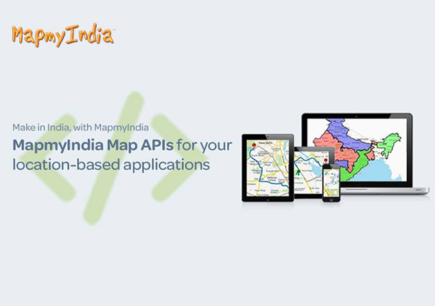
eLoc, and our 4D Digital Map Twin, is easily usable through MapmyIndia’s free Map Portal (https://maps.mapmyindia.com) and MapmyIndia Move App (https://mapmyindia.com/move). We’re also collaborating closely with ISRO to take this to the next level by integrating with their huge catalogue of satellite imagery and earth observation data. MapmyIndia’s APIs (https://www.mapmyindia.com/api) will be used by ISRO and can be used by all app developers, businesses and government organisations. Many are already using MapmyIndia’s maps, apps and APIs – but with this reform, that will explode.
We thank them for their untiring faith in us, and look forward to serving all Indians.
To learn more – visit www.mapmyindia.com