


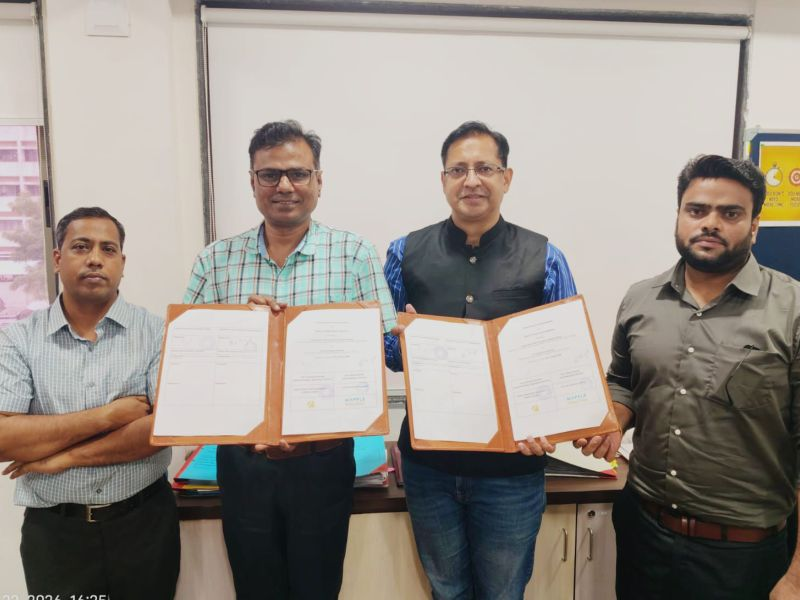
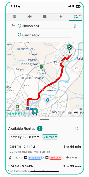
MapmyIndia has partnered with Gujarat Metro Rail Corporation (GMRC) to bring Gujarat Metro information to the Mappls App, making it easier for commuters to discover and plan metro journeys alongside other modes of transport.
With the integration, passengers can access key metro information including nearby stations, routes, fares, train frequencies, interchange information, and estimated travel times directly within the Mappls App. This brings essential public transport information closer to commuters at the point of planning their journey, helping them understand their options and choose routes more efficiently.
By bringing public transport information into a single navigation experience, MapmyIndia is making it easier for users to incorporate metro travel into their everyday journeys. Whether commuting across the city or planning a journey to an unfamiliar destination, access to metro information alongside location and navigation capabilities can help users make more informed travel decisions.
The integration also strengthens Mappls as a platform for multimodal mobility, where different modes of transport can come together to support a more seamless journey. As cities evolve and public transport becomes an increasingly important part of urban mobility, connecting digital navigation with public transportation can help make everyday travel more accessible and efficient.
The Gujarat Metro integration is another step in MapmyIndia’s continued efforts to use indigenous maps, location intelligence, and mobility technologies to build more connected transportation experiences and support smarter urban mobility across India.
Multimodal Route Planning on the Mappls App
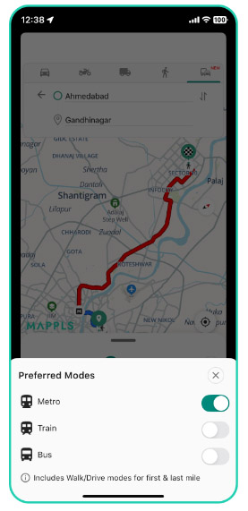
Preferred Mode
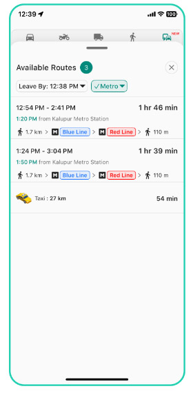
Preferred Mode
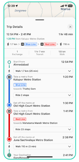
Preferred Mode
Preferred Mode


 For Solutions : +91-7948 083 370
 For Gadgets : +91-9999 333 223