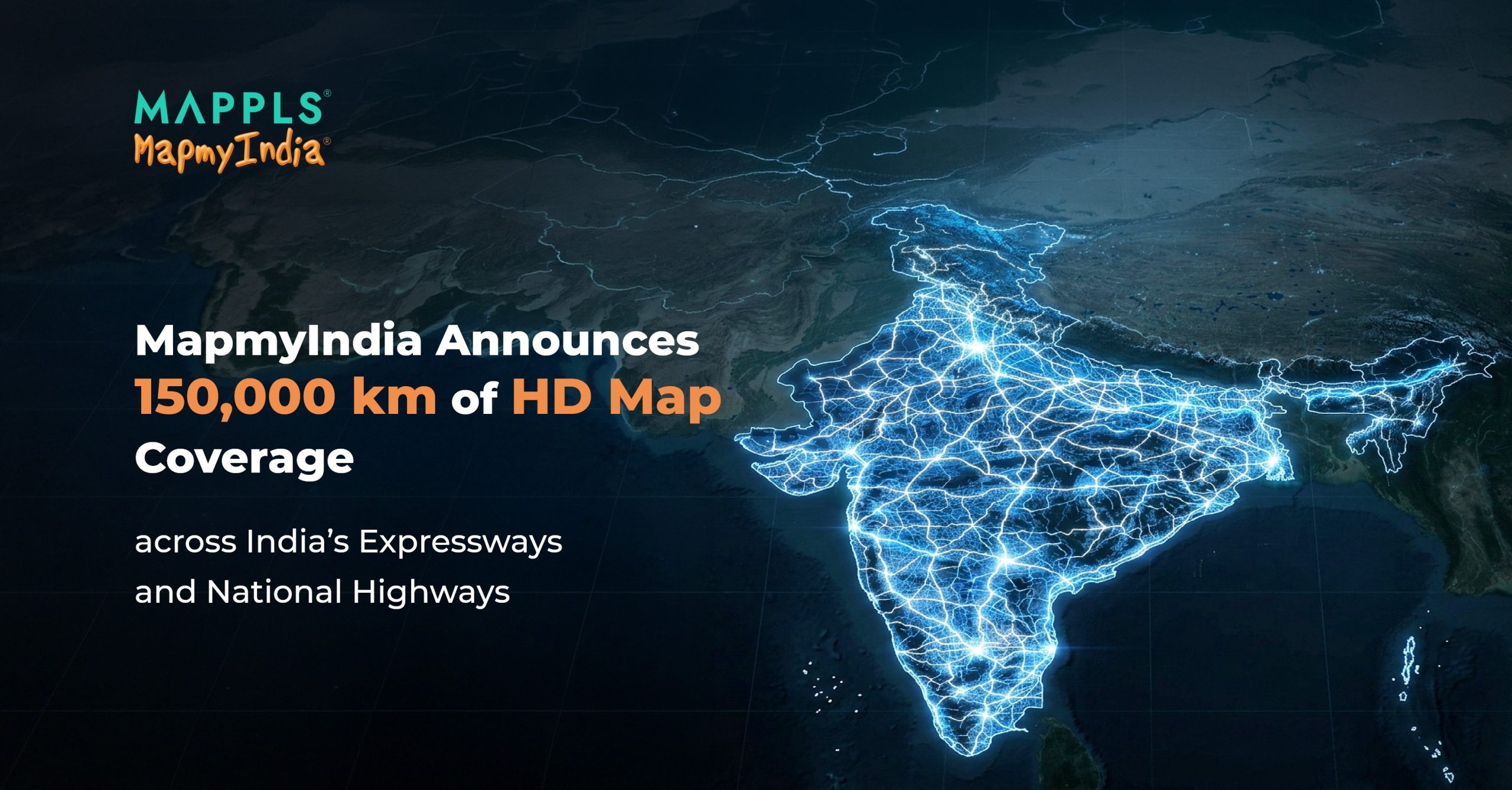
MapmyIndia has announced the readiness of its High-Definition (HD) Map Data, with full coverage of expressways and national highways spanning over 150,000 km across India. This milestone marks an important step in strengthening the country’s digital mapping infrastructure and supporting the evolution of intelligent mobility.
This milestone, together with MapmyIndia’s world-class navigation and ADAS software within the NCASE Mobility Suite for EVs, AVs, SDVs, and AIDVs, further strengthens India’s growing ADAS and autonomous driving ecosystem.
Enabling the Next Generation of Mobility
Built with centimetre-level accuracy through rigorous on-ground survey operations, MapmyIndia’s HD maps capture the geometric and semantic richness of India’s expressway and national highway network.
This level of mapping intelligence enables vehicles to interpret road environments with far greater precision, forming the foundation for advanced driver assistance and autonomous driving systems.
A Seamless Upgrade Path for Automotive OEMs
Mappls MapmyIndia navigation solutions — accurate, fresh, and road-tested across millions of vehicles over multiple years — now offer automotive OEMs a seamless upgrade path.
With HD maps now available, manufacturers can transition from high-precision navigation to ADAS and autonomous capabilities, powered by SD and HD maps working together with vehicle software, hardware, and sensors.
As vehicles evolve from assisted driving to higher levels of autonomy, HD and SD+ maps become a critical intelligence layer, enabling:
- precise localisation
- lane-level awareness
- contextual understanding of road environments
- predictive safety
These capabilities allow vehicles to interpret and respond to road conditions with greater accuracy.
Built for India’s Unique Road Environment
India’s roads present unique challenges. A single highway corridor can transition from a controlled-access expressway to complex multi-level interchanges within a short distance.
Mapping such environments with the precision required for ADAS demands extensive on-ground operations, deep local expertise, and continuous data refinement.
MapmyIndia’s HD maps are developed as part of the Atmanirbhar Bharat vision, ensuring that the digital intelligence powering next-generation vehicles on Indian roads is indigenous, secure, and purpose-built for India’s mobility ecosystem.
MapmyIndia also acknowledges the contribution of Prashant Advanced Survey LLP, whose collaboration supported the HD data acquisition process.
The Foundation for What Comes Next
Lane-keeping assistance. Adaptive cruise control. Traffic jam assist. Highway pilot.
The capabilities being deployed in modern vehicles — and those expected in the coming decade — rely on mapping intelligence that is precise enough to guide decision-making, not just display navigation.
With 150,000 km of HD-mapped expressways and national highways now ready for OEM integration, MapmyIndia is strengthening the digital mapping infrastructure required for the next phase of intelligent mobility in India.
The future of autonomy is built on precision.
And precision begins with trusted, indigenous maps — powered by Make in India MapmyIndia Maps.