For over three decades, MapmyIndia has been building India’s own maps and navigation technologies — designed from the ground up for the unique needs of Indian roads, infrastructure, and citizens. Central to this journey has been a long-standing collaboration with the Ministry of Road Transport & Highways (MoRTH), aimed at leveraging location intelligence and navigation technology to make travel across India safer, smarter, and better informed for every traveller.
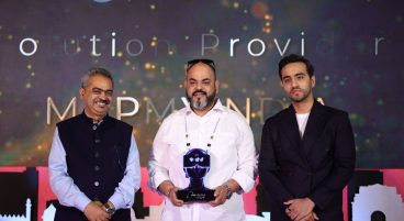
In a recent engagement, Mr. Rohan Verma, Board Member, MapmyIndia, and Managing Director – Mappls DT & Gtropy, met with Hon’ble Minister Shri Nitin Gadkari Ji to discuss the progress of key initiatives being undertaken in collaboration with MoRTH.
The conversation reflected the depth and continuity of this partnership — centred on how location technology can address real challenges on Indian roads and meaningfully improve the travel experience for millions of citizens across the country.
The initiatives being developed in collaboration with MoRTH are focused on one overarching goal — making every journey across India more informed, more aware, and more secure for the traveller.
From helping users better understand the costs and savings associated with toll infrastructure, to delivering timely and relevant safety information along active routes, these initiatives are designed to put the power of location intelligence directly in the hands of everyday travellers — in a way that is practical, accessible, and built specifically for Indian road conditions.
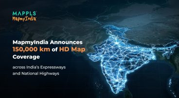
India’s road network is one of the largest in the world, and navigating it safely requires technology that understands its complexities — the infrastructure that is constantly evolving, the conditions that vary dramatically across geographies, and the safety challenges that remain very real for millions of road users every day. This is precisely where MapmyIndia’s collaboration with MoRTH is focused.
What makes this collaboration particularly meaningful is what it is built on. MapmyIndia’s maps and navigation technologies are not adapted from global platforms — they are built here, maintained here, and developed with an intimate understanding of how India moves.
During the meeting, Rohan also had the privilege of presenting MapmyIndia’s iconic Ramayan Map to the Hon’ble Minister. Mapping one of India’s most culturally significant journeys using modern geospatial technology, the Ramayan Map is a testament to how MapmyIndia’s work goes beyond navigation — using the power of maps to celebrate and preserve India’s rich cultural and civilisational heritage. The gesture was warmly received and reflects the unique intersection of technology and tradition that defines much of what MapmyIndia stands for.
This philosophy of indigenous, Swadeshi innovation has guided MapmyIndia since its founding and continues to shape every initiative the company undertakes with government partners. The collaboration with MoRTH is a reflection of that commitment — bringing homegrown technology to bear on some of the most important mobility and road safety challenges facing the country today.
As India’s infrastructure landscape continues to evolve rapidly — with new expressways, smart highways, and connected mobility projects shaping the future of how the country moves — MapmyIndia remains committed to being a trusted technology partner to the government, contributing through intelligent, reliable, and user-centric solutions that serve the nation’s best interests.
Experience MapmyIndia’s navigation built for India’s roads.
Download the Mappls App: https://mappls.com/getApp