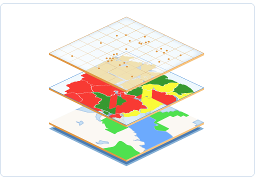
A lot of ongoing initiatives have been introduced recently from within the geo-spatial Indian industry and by the Government of India. Coupled with the newly emerging areas being targeted for expanding services, the Geospatial sector is poised for an explosive growth within and outside India. The trigger for all this has come from the availability of GIS, GNSS and imagery mapping of Earth from outer space. There also seems to be a consensus within industry sources that this growth will be driven by Big Data, Cloud servers, Internet of Things and Artificial Intelligence.
For all this to happen there has to be a coming together, a merging of technologies which is non-existent today. Each industry segment is secure and knowledgeable within its own sphere. For growth to happen, alliances will need to be formed to enable sharing expertise of one industry segment with another and the creation of joint projects.
The emerging requirements worldwide for smart cities, and more generally, smart technology, necessitate a convergence of different and diverse technologies. Interestingly, there was the re-emergence of the “Digital Twin” which was so eloquently and graphically discussed by MapmyIndia’s Rohan Verma during the full day seminar held on “Map the Future” at Gurgaon in April 2017. It came center-stage once again as the Geospatial World Forum 2018 held at Hyderabad on January 17th, 2018.
Some of the other areas of discussion included the “re-discovering of distributed GIS, analytics, real-time mobility and community engagement with GIS.” With spatial analytics taking priority, it has become necessary for the industry to focus and in a way re-learn. The new nitty-gritty concepts of “the where, the size and shape, the relationship between places, the best locations and paths, the patterns and making predictions” are said to be of paramount importance now.
It is predicted that the hundreds of billions being generated as revenue by the geospatial segment worldwide are slated for a mega-jump. A continuous growth rate of 13.6% is expected till 2020. The Indian share of this market is expected to be a far larger percentage, based on its nascent stage, than it is today. Increased usage of geospatial technology is expected in segments like BFSI, Construction, Agriculture, where this technology is already being used. Some of the emerging areas demanding penetration are areas like Disaster Management, Forest Cover Imaging, Environment Modelling, Infrastructure and Urban Development, and Identifying and Managing Water Resources.
An interesting insight of the Indian segment of the geospatial industry during the recent World Forum was its focus on improving living conditions of the people of India. Geospatial technology and the tiny percentage of service providers in India still have many industry segments to tap and penetrate. The advantages of the technology lie in its ability to support all these segments in improved cost-effectiveness, increased efficiency and accuracy, greater transparency and better planning, with all these leading to much faster decision making in government and private sectors.
Quite interestingly, subsequent to the Hyderabad meeting held recently, the AGI (Association of Geospatial Industries) signed a Memorandum of Understanding with the EARSC (European Association of Remote Sensing Companies) for increased collaboration between the two. This was signed on the sidelines of the Geospatial World Forum in Hyderabad recently.
As seems evident, alliances are in progress now with the signing of this agreement and the ball has been set rolling for the coming together of technologies.


