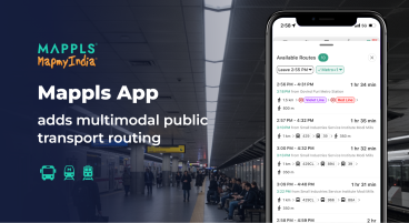
- 35 Million+ Mappls App Users to access real-time Delhi Metro information like routes, fares, and train frequencies at a glance
- Enhanced commuter convenience, making metro travel smarter, faster, and hassle-free across the Delhi NCR
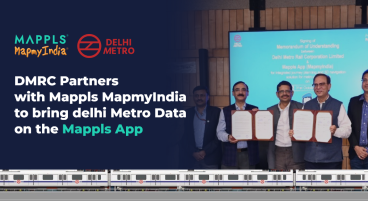
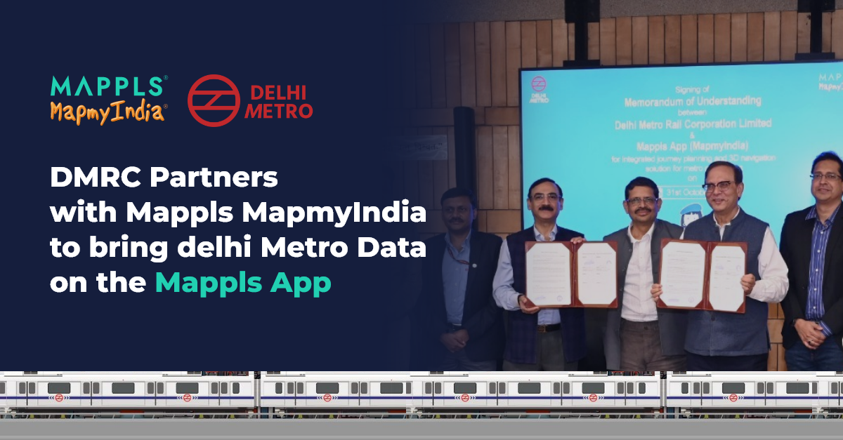
The Delhi Metro Rail Corporation (DMRC) today signed a Memorandum of Understanding (MoU) with Mappls MapmyIndia, one of India’s leading digital mapping and geospatial technology companies, to integrate DMRC’s API within the Mappls App.
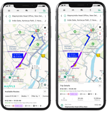
As per the MoU, DMRC’s Metro data will now be integrated with the Mappls platform to enhance commuter convenience across Delhi-NCR. Over 35 million Mappls app users will soon be able to access detailed metro information including nearby stations, routes, fares, line changes, train frequencies, and travel times directly within the Mappls App.
Commenting on the partnership, Dr. Vikas Kumar, Managing Director, Delhi Metro Rail Corporation (DMRC), said: “Delhi Metro is committed to enhancing commuter convenience through innovation and technology. The integration of DMRC’s metro data with the Mappls app will make travel across NCR smarter and seamless — enabling commuters to plan better, navigate easily, and save time. This collaboration marks another step toward building a smarter, safer, and more connected public transport ecosystem.”
Mr. Rakesh Verma, Co-Founder, Managing Director, and Group Chairman, MapmyIndia, added: “Soon the DMRC data will get integrated into the multi-modal transport feature of the Mappls app, making travel across the Delhi NCR faster, smarter and seamless. The signing of the MoU with DMRC comes at the heels of the recent announcement by the Hon’ble Minister for Railways, Electronics & IT, Shri Ashwini Vaishnaw regarding an MoU between Indian Railways and Mappls MapmyIndia. This is a strong step towards the signing of the MoU with the Indian Railways as envisaged/tweeted by Shri Ashwini Vaishnav. We are proud to be recognized as India’s premier location tech provider by some of highest echelons in the Indian Government. We promise to deliver more of Swadeshi tech that is world class and work towards the realization of an Aatmanirbhar Viksit Bharat. ”
The initiative also promotes transparency, accessibility, and citizen participation through Mappls App’s advanced Traffic and Public Engagement Platform. With this integration, the Mappls App will not only guide metro commuters but also help citizens locate nearby government services, receive optimized routes with estimated travel times, and report real-time civic and traffic issues such as congestion, accidents, parking challenges, or waterlogging, all directly from their smartphones.
These citizen-driven inputs will be shared instantly with relevant authorities, ensuring faster responses, proactive traffic management, and improved urban mobility across the region. The Mappls platform will further enhance public safety by providing real-time alerts on road incidents, accidents, or breakdowns, while helping emergency services respond faster and keeping Delhi-NCR’s roads safer and more efficient for everyone.
About MapmyIndia & Mappls (C.E. Info Systems Ltd) www.mapmyindia.com & www.mappls.com C.E. Info Systems Ltd. (NSE: MAPMYINDIA; BSE: 543425) is India’s leading advanced digital maps and deep-tech company, popularly known in India as MapmyIndia and globally as Mappls. The company offering proprietary digital maps as a service (“MaaS”), software as a service (“SaaS”) and platform as a service (“PaaS”), including its advanced digital map data, software products, platforms, application programming interfaces (“APIs”), IoT and solutions to new-age tech companies, large businesses, automotive OEMs, government organisations, developers and consumers. The company has served more than 2000 enterprise customers since inception. The company pioneered digital mapping in India in 1995 and has earned its market leadership position in this industry and built a strong moat by capitalizing on our early mover advantage, developing proprietary and Incorporated technologies, full stack product offerings, continuous innovation and robust sustainable business model. The company also built India’s very first internet mapping platform and portal, MapmyIndia.com (now called Mappls.com) in 2004. The company’s free Mappls App for consumers provides the best and fully indigenous maps, navigation, safety, hyper local and IoT gadget-enabled experience for Indian users.
MapmyIndia has built India’s most comprehensive, accurate, feature-rich and continuously updated digital map data product down to address and urban building level detail pan India, covering all towns, villages, and the entire road network of the country. The company is building not just 2D maps, but also 3D (with landmarks, terrains and city models), 4D (updating in near real-time), HD (high-definition and high-accuracy), RealView (geo-tagged 360 degree panoramas, videos and photos representing actual ground reality), and hyper-local geo-demographics data-rich maps, to continuously evolve its AI-powered Digital Metaverse Twin of the Real World. The company is also building digital maps for other regions in the world, and has Incorporated global maps for over 200 countries into its Mappls platform. The company’s platform provides extensive and comprehensive functionalities and ever expanding set of use cases, including mapping, location and navigation, geospatial data analytics, GIS (geospatial information systems) and AI, GPS tracking and IoT-based fleet management, logistics optimisation and workforce management, drone-based solutions, developer APIs, N-CASE solution suite (for Navigation, Connected vehicle telematics and services, ADAS safety i.e. advanced driving assistance systems, Shared and Electric) for Automotive & Mobility Tech (A&M), and Consumer tech and Enterprise digital transformation solution suite (C&E).
***
For further information, please contact:
C.E. Info Systems Ltd. (MapmyIndia & Mappls) PR
Email: pr@mapmyindia.com
www.mapmyindia.com / www.mappls.com / https://about.mappls.com
White Fish Communications
Anil Nagwani (+91 9811268046; anil@wfc.in)