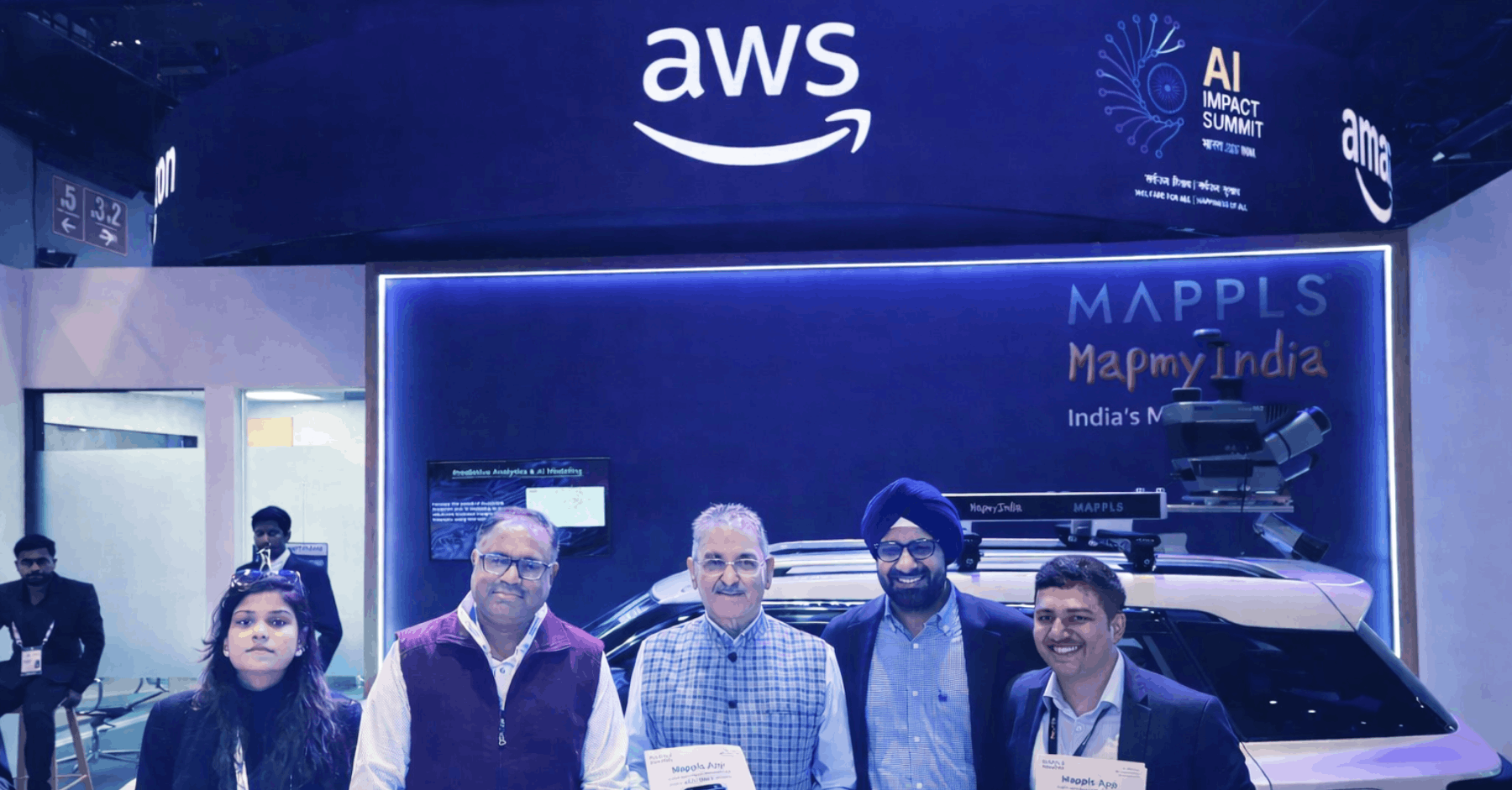
MapmyIndia recently participated in the India AI Impact Summit 2026, showcasing how applied AI and geospatial intelligence are enabling real-world impact across mobility, logistics, governance, and digital infrastructure.
The summit provided an opportunity to demonstrate how location intelligence is becoming an essential layer for decision-making across both public and enterprise ecosystems.
We were honoured to welcome Shri Kavinder Gupta, Governor of the Union Territory of Ladakh, to our stall during the event. The interaction highlighted how AI-powered geospatial technologies can support smarter mobility systems, infrastructure planning, and data-driven governance initiatives.
The team also engaged with senior officials from the Department of Posts, India, discussing how location intelligence and data-led decision-making can strengthen logistics planning and significantly improve last-mile delivery efficiency across the country.
Demonstrating HD Mapping and Next-Generation Mobility
A key highlight at the booth was MapmyIndia’s HD Maps-enabled vehicle, demonstrating how high-definition mapping technology supports advanced driver assistance systems (ADAS), safer navigation, and next-generation mobility use cases.
High-definition maps form a critical intelligence layer for modern mobility systems, enabling precise localisation, lane-level awareness, contextual road understanding, and improved driving safety. As vehicles evolve towards software-defined and autonomous capabilities, HD mapping becomes increasingly important in enabling intelligent mobility infrastructure.
Powering Everyday Navigation with the Mappls App
The summit also provided an opportunity to showcase the Mappls App, India’s homegrown navigation and location intelligence platform.
Designed specifically for Indian roads and mobility conditions, the app offers highly accurate maps, real-time traffic updates, advanced 3D junction views, and a range of intelligent navigation features that enhance everyday travel for millions of users.
Download the Mappls App here:
https://mappls.com/getapp
Advancing India’s AI and Geospatial Ecosystem
The discussions and demonstrations at the summit reinforced a growing recognition that AI and location intelligence together form a critical foundation for India’s next phase of digital infrastructure development.
From intelligent transportation systems and logistics optimisation to infrastructure planning and digital governance, the integration of artificial intelligence with geospatial intelligence is unlocking new possibilities for how organisations and governments operate.
As India continues to scale its digital and physical infrastructure, technologies that combine AI, maps, and location intelligence will play a central role in enabling smarter, more efficient systems across sectors.