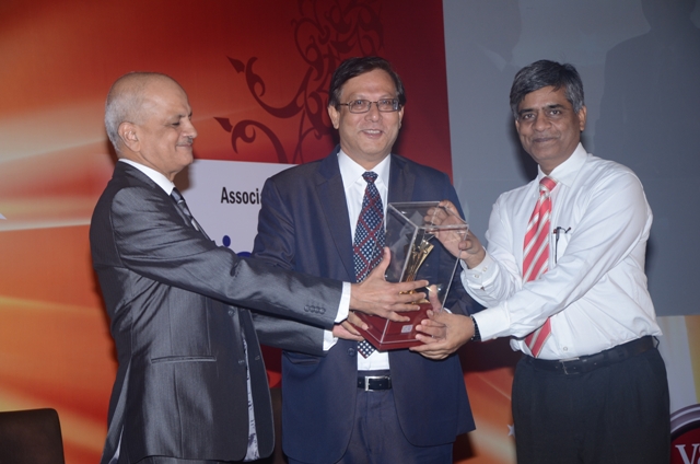
| V&D 100 Awards: Technovator of the Year-MapMyIndia |
| Its comprehensive and unparalleled innovations has set the ball rolling to power navigation and LBS services
At the time when digital maps were unavailable for India and GIS was not a word commonly known, MapMyIndia awakened the Indian industry to its most comprehensive, accurate, robust, and reliable navigable map database for the entire country. It was not a long time when GPS navigation systems and applications were alien to the Indians on the move. It was until last few years that this concept popularized the technology of navigation tools and applications and gave rise to a new industry which was already booming in the western world.
“We are currently providing GIS based enterprise solutions to 500 leading corporates and government organizations, eg, Motorola, GM, Mahindra, Mantri, Ford, Mitsubishi and we have 150+ employees, 200+ field surveyors working 24/7 for giving our customers error-free reliable resource,” says Rakesh Verma, MD, MapmyIndia. Innovations MapmyIndia’s comprehensive map coverage of India, unparalleled in industry, has set the ball rolling to power many navigation and location based services coming to India, as MapmyIndia is aggressively inviting and partnering leading players from India and around the world to tap the vast potential Indian consumer market. The company has tied-up with Qualcomm as a strategic investor. Qualcomm empowered it and brought it into its eco system and with this, its thrust started in the telecom vertical. Recently, the company has tied-up with a Japanese company called Zenrin as a strategic investor, It the largest mapping company in Japan and the third largest in the world. It will help MapmyIndia in faster technology absorption thereby helping it to lead the market. MapMyIndia has provided GIS based enterprise solutions to over 500 leading corporate and government organizations in every vertical. In the internet space, it competes with Google Maps and Yahoo! Maps. MapmyIndia released the most comprehensive navigable map for India in 2006 and brought Yahoo! Maps to India, supplying them the map data to create their own online portal. In the automotive space, they have 80% market share in portable navigation devices. Their competitors are Garmin and SatGuide. In the digital mapping space, MapmyIndia has done a clean sweep in handset and automotive space. Here the competitors are Navteq (a Nokia company). MapmyIndia has taken incredible strides, becoming one of India’s first web 2.0 portals when it released its AJAX version in September 2006 and the latest version release has helped searching and getting directions from any point in India very easily and relevantly. Recently, MapmyIndia’s navigable map also started powering airtel GPS navigation on the BlackBerry with more phones in the offing. Presently, MapmyIndia applications are available on iTunes and is the #1 growth seller for the last 12 months. Once the operator plans to provide TeleNav service, the company is planning to provide this service to end consumer at one-time transaction fees of `10 or `20. If a handset vendor is planing to offer this service on the handset, the company is planning to charge `2,500. For the first time in India, MapmyIndia along with Nuance Coomunications is offering GPS navigators that give voice guidance with accurate pronunciation of Indian street and road names. Voice guidance is now available in 8 regional languages in addition to Hindi and English. Upbeat with changing technologies and bridging the gap between west and east, MapmyIndia introduced augmented reality-a latest 3-D technology for landmarks and 2-D building footprints across 20 cities. Industry leaders seek MapmyIndia as a partner because they have today positioned themselves as one-stop-shop for all their map data requirements. “Today, we have successfully deployed our services across all media-PNDs/PDAs, internet, wireless, and print. We are constantly maintaining currency of our maps, despite the rapidly changing landscape across India. This is possible because MapmyIndia’s maps are constantly being used and validated by a customer base of 500 large enterprises and millions of individual consumers,” informs Verma. The company is planning to grow 100% year after year. The revenue was `42 crore in FY11 and is predicted to be `100 crore in FY12. The company has total investment of $14 mn from Kleiner, Sherpalo, Nexus, and Qualcomm apart from $20 mn from Zenrin recently.
The company is a part of the Planning Commission for National GIS program to guide the government for the next 10 years of planning and this mapping space will support country’s economic and security development. “The company has customized its offering to cater to different segment, different business to leverage its offerings,” says Verma. MapmyIndia’s enterprise GIS solutions are enabling enterprises in areas of sales, marketing by providing population, and income distribution details. Company’s vehicle and tracking solutions are popular among enterprises today. It’s also offering customized applications for enabling location enabled Business Intelligence (BI). MapmyIndia’s web based application developer framework provides access to its rich maps data set to application developers. India’s widely used map APIs are used by leading financial institution and web based applications. Maps and location based services are now ‘de facto’ feature for mobile phones. MapmyIndia has extensively worked to support handsets, OEMs ranging from open platform smartphone to native platform feature phone environment. There are plenty of MapmyIndia map applications on open mobile platforms like Windows mobile and android. Journey So Far The company was founded in 1992 by the entrepreneur couple Rakesh and Rashmi Verma, who had returned after a 12-year stint in the US working for General Motors and IBM, respectively. The company’s initial focus was on providing training and solutions on the IBM mainframe platform. 1994-2004: Over the next 10 years, from 1994-2004, the company focused single-mindedly on creating the complete India map data product. The challenges the company faced in creating this massive data set were 2-fold-how to bear the large amount of investment needed to build the data and how to ensure the huge database stayed relevant and up-to-date. The company’s strategy to address these challenges was elegant and simple ie, provide enterprises with GIS solutions on top of the map data that added significant tangible benefits to its business operations and planning. In this way, the company was able to generate a revenue stream to drive future investments into building the map data. And because the enterprises were using it for its operations on a daily basis, it would provide the necessary feedback to ensure currency of the data. For example, in 1995 when Coca-Cola wanted to re-enter India, the company provided it in planning their logistics and distribution of bottles from the bottling plants to almost every town and village across India. Similarly, in 1996 when Hutch (now Vodafone Essar) was deciding where to place its tower based on demand, CE Info built the map data and model on the top of it to recommend the locations. CE Info became the first distributor for Map Info in 1994 and set about the massive and pioneering task of mapping out all of India. “When we started making digital map, 2 things happened-Coca-Cola entered the Indian market and FMCGs started using this kind of technology for sales marketing and distribution. They needed digital maps as the base. The second development was an announcement of mobile telephony and putting digital map for RF site. Keeping these two in mind as immediate customers, our business took off from there,” explains Verma. 2004-Current: In 2004, the company analyzed the mapping trends and application around the world and saw that in US and Europe, maps had become common by the individual consumers. Online map portals such as Yahoo! Maps and Map quest were very popular (Google Maps had not released then, it came online in February 2005) and in Europe people were beginning to get familiar with GPS navigation devices that could guide a person while driving to his destination. There is no looking back for this technovator of the year and has surely paved way for many more such technovations strengthening the Indian telecom roads. Akanksha Singh akankshas@cybermedia.co.in https://voicendata.ciol.com/content/vNd100/211082303.asp
|
-
Products
Products
- Map and Data
- APIs and SDKs
APIs and SDKs
-
See all APIs

Explore our entire suite of APIs & SDKs
Maps
SDKs for maps and traffic
Search & Geocoding
APIs for search and discovery
-
Routes & Navigation
APIs to solve complex routing problems
-
Navigation SDK
Connected embedded navigation
Mobility & Tracking
SDK to enable live location in your apps
-
Global APIs
Maps, search, routes for 238 nations
Personalisation SDK
Hyperlocal, personalised O2O marketing
-
Optimisation APIs & SDKs
Route planning & optimisation
GIS and Analytics APIs
GeoBI meets Location AI
Workmate APIs
Field force automation APIs
Mappls App URLs
Embed maps, navigation in your apps
NaviMaps SDK APIs
Hybrid navgation for embedded systems
-
See all
APIs
-
- GIS, Analytics and AI
- IoT and Automation
- Navigation and
Mobility
Navigation and Mobility
NCASE Automotive Suite
Intelligent mobility platform for PV, CV, EV
Navimaps
Offline navigation maps and app
Mappls App
Super app for maps, safety, and more
-
Navigation SDK
Connected embedded navigation
-
RouteNet
Connected embedded navigation
Traffic AI (coming soon)
Convert movement data to traffic analytics
- Digital Twin
- Consumers
- Developers
- Solutions
SolutionsBy Vertical
- Consumer
- Developers
- Developers
Developers
- Map APIs & SDKs
Maps
SDKs for maps and traffic
Personalisation SDK
Hyperlocal, personalised O2O marketing
Search & Geocoding
APIs for search and discovery
-
Routes & Navigation
APIs to solve complex routing problems
-
Navigation SDK
Connected embedded navigation
-
Optimisation APIs & SDKs
Route planning & optimisation
RealView APIs
APIs for 360° panoramic images
- Analytics APIs
- Telematics APIs & SDKs
- Mappls Apps APIs & SDKs
- Advanced APIs & SDKs
- Use Cases
- Documentation
- Demos
- Map APIs & SDKs
- Company
- Resources
- Investors
- Contact us


 Today,
  Pushing partnerships to build a successful eco system, MapmyIndia has forged alliances with all leading navigation players to unlock the vast potential of the Indian


