Call at Mappls
Product release

Boost your businesses with Mappls’ industry-leading optimisation APIs and SDKs to bring the best and most efficient ways to deliver goods, save time and increase profits.

or

Mappls Geo-Analytics APIs

With Mappls Interactive Map JS Library

Mappls Geo-Analytics APIs

(With Mappls Interactive Map JS Library)

Compatible Web Browsers

  • Google Chrome (Version 67 and above)
  • Mozilla Firefox (Version 60 and above)

URL for the Mappls Interactive Map JS

https://apis.mapmyindia.com/advancedmaps/v1/your_map_key_here/map_load?v=1.3&plugin=geoanalytics

where: plugins available are:

  1. kml: to display kml overlays over Mappls Maps.
  2. geoanalytics: to use Mappls Geo-Analytics Core APIs with Mappls as basemap layer.
  3. cluster: to use a simple clustering with Mappls Maps.
  4. prunecluster: to use advanced clustering with Mappls Maps.
  5. path.drag: to enable drag-able polyline based objects with Mappls Maps.
  6. editable: to draw editable polygon overlays on Mappls Maps.

Fetching & Displaying overlays using GeoAnalytics APIs

Getting Layers

This method gets the layer specified which is stored in Mappls' Database and gives a WMS layer as an output with any filters or styles specified by the user. Example: geoAnalytics.getState, geoAnalytics.getCity, geoAnalytics.getPincode, etc.

Method name

geoAnalytics.get<LayerName>

where

Parameters

Parameters are sent to the APIs as geoparams

  1. AccessToken (Mandatory; string): These APIs follow OAuth2 based security. To know more how to create your authorization tokens, please use our authorization URL. More details are available here
  2. GeoBoundType (String; Mandatory): The type of geographical extents on which data would be bound, i.e. the parent layer types (India, State, District, Sub District, etc.)
    Note: To see the list of available parent later types, contact apisupport@mappls.com.
  3. GeoBound (Array of Strings; Mandatory): The values of the extent depending on the GeoBoundType. (Array of Names)
    Note: To fetch the list of available types, see the Listing API here. here
  4. Attribute (String; Optional): The name of Attribute to filter the output, such as population or number of households.
    Note: To see the list of available parent layer types, contact apisupport@mappls.com.
  5. Query (String; Optional*): A string containing an operator and a value which would be applied to the attribute filter. Applicable queries include < (Less than) OR > (Greater then) OR <> (Between). Example 1: ‘> 10000’ Example 2: BETWEEN value1 AND value2
    *Note: Query is mandatory if Attribute is given.
  6. Style (Object; Optional):
    • Label (Boolean; Optional*): Value to display labels. Set as true OR false.
    • LabelColor(Hex Value; Optional*): Value of the color of label.
    • LabelSize(Number; Optional*): Size of labels to be displayed.
    • FillColor(Hex Value; Optional*): Value of the polygon/point color.
    • PointSize(Number; Optional*): Size of point data. (Applicable for Point geometry only)
    • BorderColor(Hex Value; Optional*): Value of the color of the label.
    • BorderWidth(Number; Optional*): Width of the polygon border.
    • Opacity(Float; Optional*): Opacity value of whole layer. (Any range between 0 & 1) *Note: All starred parameters are mandatory if Style is given.

Example

var geoParams = 
{
	GeoBoundType	:	'stt_nme',
	GeoBound		:	['haryana'],
	Attribute		:	't_p',
	Query			:	'>10000',
    Style: 
		{
			Label		:	true,
			LabelColor	:	'13592e',
			LabelSize	:	10,
			FillColor	:	'ffe0aa',			  
			BorderColor	:	'13592e',
			BorderWidth	:	2,
			Opacity		:	0.5
       }
};
var GeoDataLayer = geoAnalytics.getPanchayat(geoParams);
map.addLayer(GeoDataLayer);

APIs: List of Available Layers

  1. getState
  2. getDistrict
  3. getSubdistrict
  4. getTown
  5. getCity
  6. getPincode
  7. getWard
  8. getLocality
  9. getPanchayat
  10. getBlock
  11. getVillage

Layers and Attributes

To get the list of available layer's and attribute's names, please use the Listing API available here.

Getting Started

Now that you’re all caught up with the features, let's get down right to them and look at how you can integrate our Interactive Map JS API in conjunction with the above geoAnalytics methods to add data on that map to your Website from scratch.

Initializing The Map

Follow the documentation of Interactive Map API to integrate Mappls Interactive Maps into your existing code base.

Adding Your First DataLayer

To add a DataLayer to the map, go through the following steps after declaring the map object:

  • First, declare the DataLayer object
var geoParams =
{
	GeoBoundType	: 	'stt_nme',
	GeoBound	: 	['haryana'],
	Attribute		:	't_p',
	Query		:	'>10000',
	Style		:	
		{
	        Label	:	 true,
	        LabelColor	: 	'13592e',
	        LabelSize	: 	10,
	        FillColor	: 	'ffe0aa',
			BorderColor	 :	 '13592e',
			BorderWidth  :	 2,
			Opacity	: 	0.5
		}
};
  • Second, declare the GeoDataLayer object by calling new geoAnalytics.get method in the JavaScript and passing the above created geoParams object in it.
var GeoDataLayer = geoAnalytics.getPanchayat(geoParams); // for panchayat layer
  • Third, Add the GeoDataLayer object on the map on the map object created above:
map.addLayer(GeoDataLayer);
  • Finally, call the Mappls' Listing APIs to get the bounding box of the DataLayer to set the bounds of the map with respect to the DataLayer. Refer to the Listing API documentation for more information (Alternatively call the new geoAnalytics.setBounds method in the JavaScript and pass it layer name, geoParams and map objects in it to set the bounds of map to the bounding box of GeoDataLayer.
geoAnalytics.setBounds('pincode',geoParams,map); // for pincode layer

Info Windows

Info Windows are a convenient way of showing data about a point in the DataLayer. The expected behaviour of a user to know about any point in the DataLayer is to try and click on it to know what it is all about. The mechanism to accomplish this is by showing an info window. The info window for a DataLayer(created previously) can be obtained through following steps:

  • Create a click event on the map.
 map.on('click', function(e) 
{
// e stands for the event in which the click happens 
});
  • Declare the attribute names in propertyName that you want to see in the info window.
 map.on('click', function(e) 
{
var propertyName = 'stt_nme,stt_id,t_p,t_m,t_f,label';
});
  • Call a new geoAnalytics.getFeatureInfo method in the JavaScript and pass the event, propertyName and GeoDataLayer in it. This will give json response in which all the information for the requested attribute will be available.
 map.on('click', function(e) 
{
var propertyName = 'stt_nme,stt_id,t_p,t_m,t_f,label';
var Infodata = geoAnalytics.getFeatureInfo(e,propertyName,GeoDataLayer);
});
  • Create a variable html and add the data into it.
 map.on('click', function(e) 
{
var propertyName = 'stt_nme,stt_id,t_p,t_m,t_f,label';
var Infodata = geoAnalytics.getFeatureInfo(e,propertyName,GeoDataLayer);
var html = "";
if(Infodata.features[0])
			{
	 html += "<div class='mainlabel_details'><label class='label_name'>Town Name:</label> " + Infodata.features[0].properties["twn_nme"] + ""</div> ";
	 html += "<div class='mainlabel_details'><label class='label_name'>State ID:</label> " + Infodata.features[0].properties["stt_id"] + ""</div>";
	
	 html += "<div class='mainlabel_details'><label class='label_name'>State Name:</label> " + Infodata.features[0].properties["stt_nme"] + ""</div> ";
	
	 html += "<div class='mainlabel_details'><label class='label_name'>Total Population:</label> " + Infodata.features[0].properties["t_p"] + ""</div> ";
	
	 		}
	 			  else if(Infodata.features[0] == undefined)
	 			  	  console.log("Not Exists");
});
  • Finally, add the info window to the map by creating a leaflet popup.
map.on('click', function(e) 
{
var propertyName = 'stt_nme,stt_id,t_p,t_m,t_f,label';
var Infodata = geoAnalytics.getFeatureInfo(e,propertyName,GeoDataLayer);
var html = "";
if(Infodata.features[0])
	{
	html += "<div class='mainlabel_details'><label class='label_name'>Town Name:</label> " + Infodata.features[0].properties["twn_nme"] +"</div>";
	html += "<div class='mainlabel_details'><label class='label_name'>State ID:</label>" + Infodata.features[0].properties["stt_id"] + "</div>";
	html += "<div class='mainlabel_details'><label class='label_name'>State Name:</label> " + Infodata.features[0].properties["stt_nme"] + "</div> ";
    html += "<div class='mainlabel_details'><label class='label_name'>Total Population:</label> " + Infodata.features[0].properties["t_p"] + "</div> ";

    L.popup({ maxWidth: 800})
      .setLatLng(e.latlng)
      .setContent(html)
     .addTo(map);
          	  }
	  else if(Infodata.features[0] == undefined)
	  console.log("Not Exists");
	}
); 
Examples

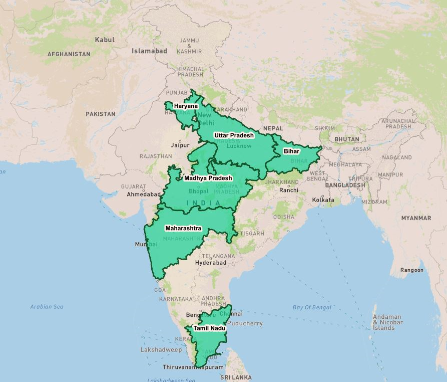
getState (some states with default style)

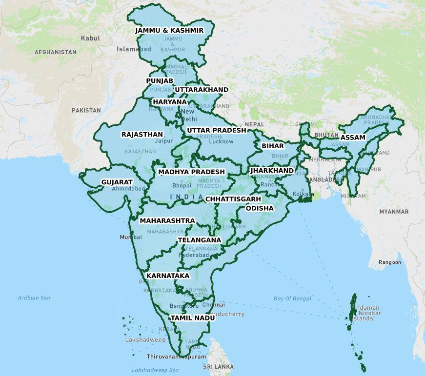
getState (all states with default style)

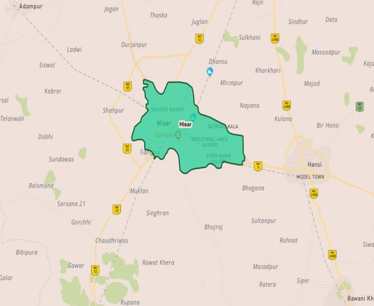
getCity(city with default style)

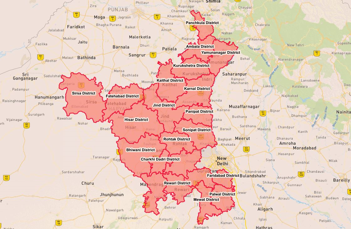
getDistrict (all districts of one state with default style)