Overview
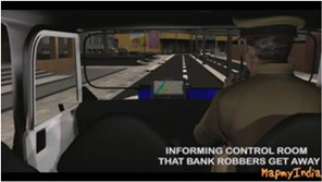
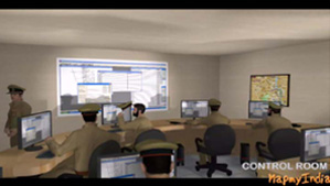
A Command and Control Center is typically a secure room or building in a government, that operates as the agency's dispatch center, surveillance monitoring center, coordination office and alarm monitoring center all in one. Especially in the Indian context, in the face of incessant attacks on its crucial networks by terrorists, as well as inadequate emergency response mechanism, the government is finalizing an elaborate plan to upgrade India's emergency response capabilities. For this, putting in place real time command and-control centers and delineating responsibilities among various agencies, is the only way forward for a safer India.
There is a lack of experience in implementing the state-of-the-art control room infrastructure without compromising on the form and functionality. There is also a huge challenge of availability of end to end solution provider in the Indian market.
MapmyIndia Offerings
MapmyIndia offers the 5 critical elements of a high quality functional CAD system in an integrated fashion:
Map Data
High precision, comprehensive and detailed maps, with house and building level detail and in full 3D
Computer-aided Dispatch Software
Efficient software to match call taking, fleet monitoring, dispatch and communication workflow of emergency responders
GPS Tracking Hardware
High quality devices which can withstand the environment conditions and communicate effectively
GPS Navigation Devices
Effective & connected navigation devices which assist the driver in reaching destination quickly and precisely
Seamless and Intelligent Systems Integration
Adapt the system to integrate and function smoothly into emergency responders' infrastructure and workflow
Mappls Command, Control & Dispatch Centre (CCC)
A robust solution to ensure quick, accurate and appropriate response by emergency response agencies through:
To deliver a high-quality CAD solution, MapmyIndiaseamlessly integrates all our high quality elements:

Precise Geo-referenced 3D, House & Building-level Street Map Data
Fleet tracking, dispatch & monitoring – SOP adherence
In-vehicle accurate navigation with voice guidance in local languages
Seamless Integration for Situation Room with Live Awareness
